OLEX
Full version for navigation, plotting and ocean mapping. Free software upgrades to future versions are included.

Full version for navigation, plotting and ocean mapping. Free software upgrades to future versions are included.

Lighter version for navigation and plotting. Free software upgrades to future versions are included.

Passive Olex for route planning, plotting/drawing and data processing. Free software upgrades to future versions are included.
Weather reports.
Interface for Subsonus underwater positioning system. Note that only Subsonus units delivered and configured by Olex can be used.
Interface for AIS tranciever.
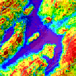
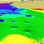
Seafloor discrimination.
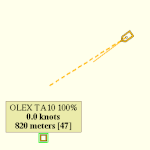
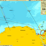
Positioning and tracking of AMRD transponders.
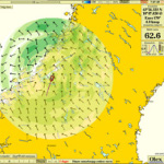
Water current mapping.

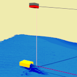
Trawl/ROV positioning.
Interface for Atec multibeam.
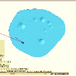
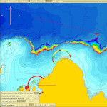
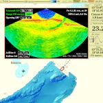
Exact singlebeam mapping.
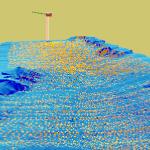
Multibeam interface made to support Kongsberg EM.
Note! New versions of Kongsberg EM might not work with Olex. Please check before buying the software.
Interface for Seapix multibeam.
Legacy interface for older
WASSP multibeam sounders.
(Models: 80F, 160F and 5230).
Note! Olex has never made any support for new WASSP generations.
Automatically exports rectangular areas of measured seabed chart, to connected trawl positioning system.