The GRIB Weather Forecast System automatically downloads the latest information about currents, waves, wind and air pressure, and display the weather with colors, arrows and graphs.
See the weather as it is now, in the future or what it will be like when the vessel pass through different areas.Information about wind, current, and air pressure can be downloaded from met.no,
or from any other provider of grib files. The presentation in the Olex is inspired by the Norwegian Meteorological Instiute (yr.no).The GRIB-module can also be set to download certain types of plotter data, such as fishing facilities,
boundaries and restriction areas, and send own tracks to a predefined email address
URL's for weather files
Weather and other data files can be downloaded from various providers like OCENS, Global Marine Network and others. If the URL to the requested files is typed in on the Olex under Download on the Settings menu, Olex will try to automatically download the files from the remote server. Lists with URLs for fetching files from various web pages can be found on our Download page.
Weather files
Wind
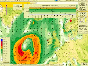
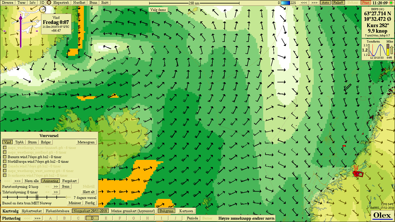
The screen shows wind arrows symbolizing the direction and strength of the wind. In addition, the colored fields show areas that have approximately the same wind speed.
Waves
The arrows show the direction and height of the waves,
in addition the colored fields show areas that have approximately the same wave height.
Surface current
The arrows symbolizes the direction and strength of ocean currents.
Fields of the same color show areas with approximately the same currents .
Air pressure
Displays areas with approximately the same pressure.
The computer must be configured to connect to the Internet, eg. via a wired connection to a modem. Most Olex machines can be connected to a network,
but older machines will probably need to be reinstalled with a new operating system first.
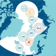
BarentsWatch collaborates with 10 ministries and 29 public agencies and research institutions. Together, tools are created by gathering,
developing and sharing information about coastal and marine areas


 The screen shows wind arrows symbolizing the direction and strength of the wind. In addition, the colored fields show areas that have approximately the same wind speed.
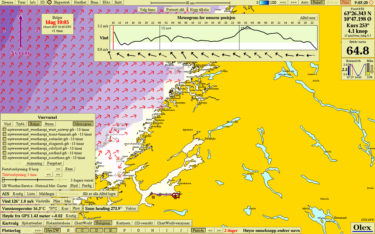 The arrows show the direction and height of the waves,
in addition the colored fields show areas that have approximately the same wave height.
The arrows show the direction and height of the waves,
in addition the colored fields show areas that have approximately the same wave height.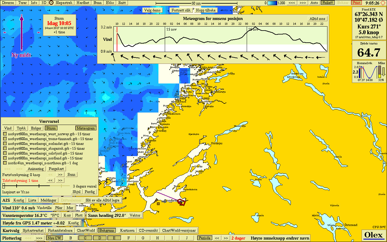 The arrows symbolizes the direction and strength of ocean currents.
Fields of the same color show areas with approximately the same currents .
The arrows symbolizes the direction and strength of ocean currents.
Fields of the same color show areas with approximately the same currents .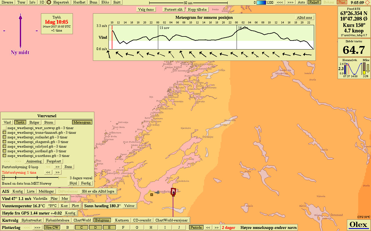 Displays areas with approximately the same pressure.