Olex MBES:
The MBES software module was developed for Olex to use data from the Kongsberg EM Series.
Note! If the MBES module is intented used together with new EM sounders, we recommend, before ordering an MBES key, to check whether the sounder has a data protocol supported by Olex.
- Compact data storage (worldwide maps on a standard hard drive)
- Fast and effective terrain modeling
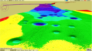
- Quick visualization of data in 2D, 3D, profile and relief
- All positioning in WGS84
- No restriction in grid-size