
Hardness with ATEC Multibeam
The sonar uses broadband technology for increased range and accuracy. With its high ping rate and wide maximum swath coverage of 180 degrees, Atec is especially effective in shallow water survey.
The below image shows hardness surveyed with Atec, south of Vega in northern Norway. Depth down to 200 meter. There are some sound speed errors, which is not effecting the hardness.
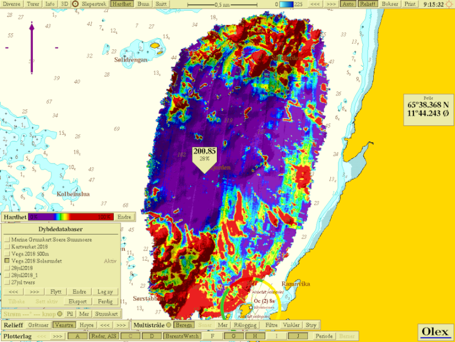 Hardness with Atec.
Next image shows a details of soft seafloor with hard craters, and some rocks at the top of the image. Depth is around 100 meter.
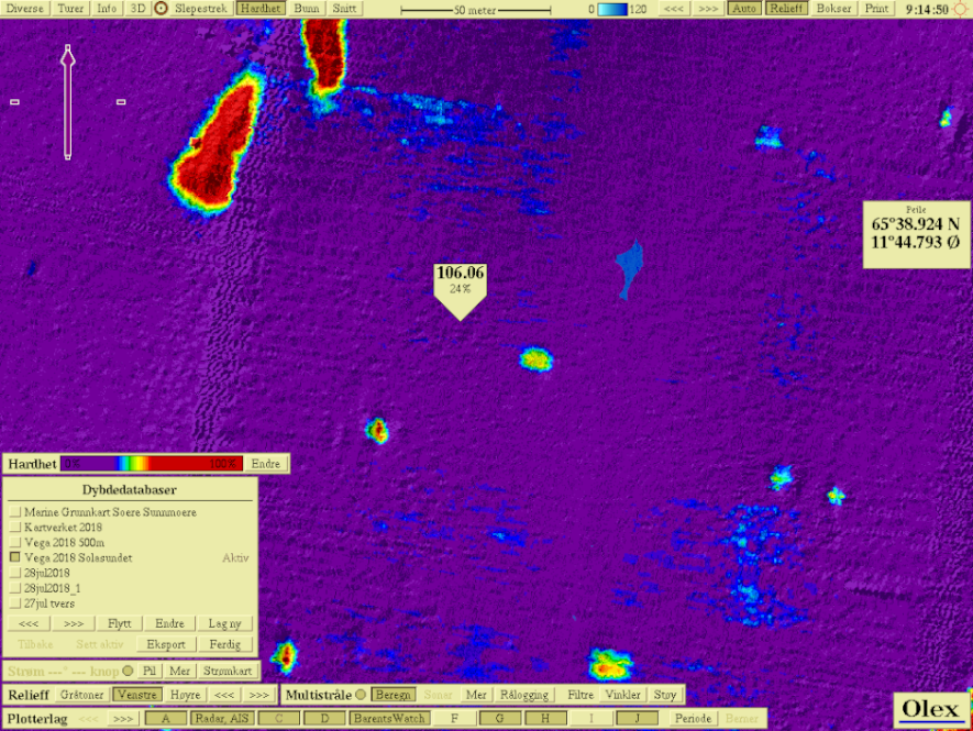 Detail. Depth around 100 m.
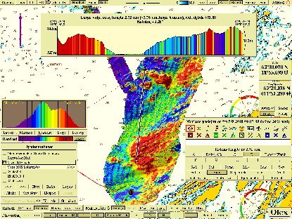
To the left - Deeper area surveyed with Atec. The depth in the fjord reaches down to 523 meter. Notice how the seabed is harder at the southern parts, even if the depths are the same. To the right - Same section, Atec bathymetry only. Notice the shift in hardness in the southern part og the picture, allthough the depth are the same.
 Hardness with ATEC
 Same area with only bathynetry.